

Hebden Bridge Flood Alleviation Scheme: October Update
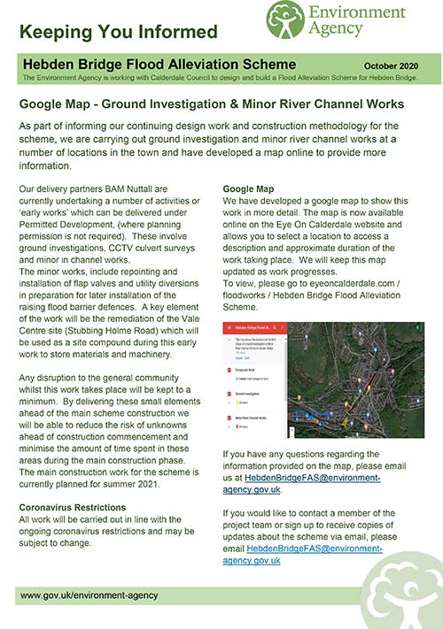
As part of informing the continuing design work and construction methodology for the scheme, the EA are carrying out ground investigation and minor river channel works at a number of locations in the town and have developed a Google map to show this work in more detail. The map is now available online on the Eye On Calderdale website and allows you to select a location to access a description and approximate duration of the work taking place. We will keep this map updated as work progresses.
To view the map, please go to https://eyeoncalderdale.com/hebden-bridge-flood-alleviation-scheme
Further details on the HBFAS can be found below:
If you have any questions regarding the information provided on the map, please email HebdenBridgeFAS@environmentagency.gov.uk. If you would like to contact a member of the project team or sign up to receive copies of updates about the scheme via email, please email HebdenBridgeFAS@environmentagency.gov.uk
Added: Tuesday, 13 October 2020

Contact Us:
Hebden Royd Town Council
St. George's Street
Hebden Bridge
HX7 7BY
Call us: 01422 842181
Email: info@hebdenroydtowncouncil.gov.uk
Follow us on Facebook and Instagram for regular news and information